Selected work

Selected work

A selection of the monitoring, forecasting and early-warning systems we have designed and operate with our clients, across environmental and socio-economic risks. Some clients are named; others are described without their name.

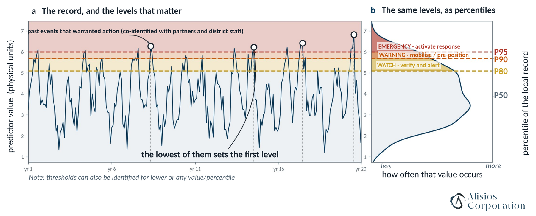
How a past record becomes Watch, Warning and Emergency levels (illustrative data).
Health

Climate-informed health early warning — Malawi

Client: Save the Children International, Green Climate Fund programme

One early-warning framework for heat, cholera and diarrhoeal disease, and malnutrition in six districts of southern Malawi, designed to plug into the national health information system (in progress, 2026). It builds on our undernutrition forecasting work in Guatemala.

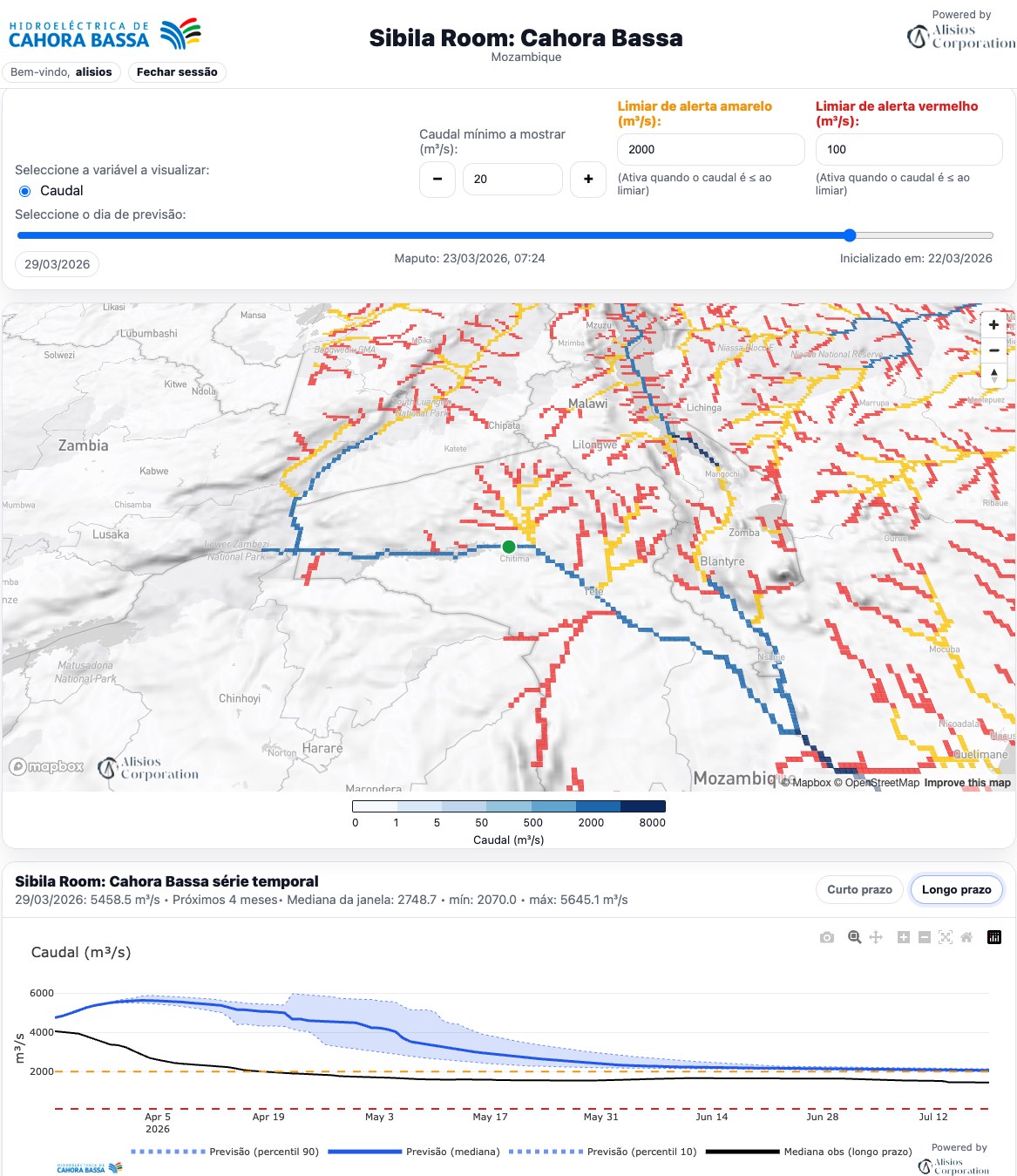
Sibila Room™ Cahora Bassa: forecast river flow across the basin and the reservoir-inflow outlook for the next four months (room in Portuguese).
Energy

Reservoir inflow forecasting for a major hydropower plant — Mozambique

Client: Government of Mozambique, through WMO

Inflow to the reservoir forecast daily up to 30 days ahead and monthly up to six months, for dispatch, maintenance and flood-risk management. The system runs automatically end to end and recovers on its own from failed data downloads, delivered through a dedicated Sibila Room™.

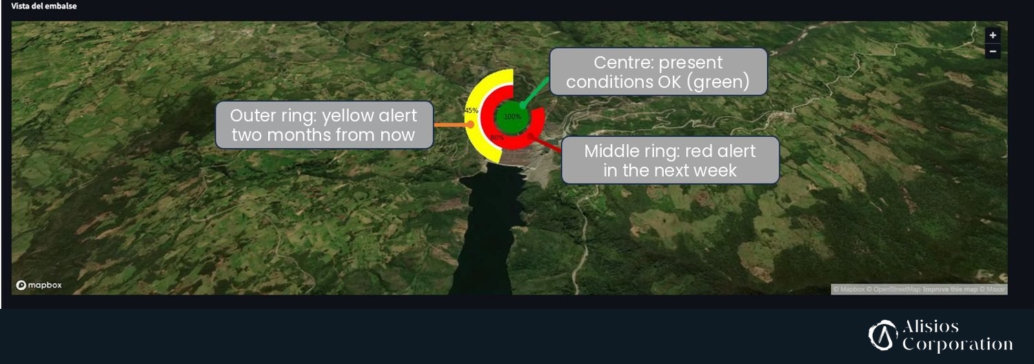
Sibila Room™ CELEC, Mazar reservoir: alerts at three horizons on one map — present conditions, the next week and two months ahead.
Energy

Flow and alert forecasting for a reservoir — Ecuador

Client: CELEC EP, Mazar reservoir (Paute basin)

Daily flow and precipitation forecasts up to 14 days and flow up to six months, verified continuously against reservoir observations. Alerts at several horizons (next week, next two months) on one map. Co-designed with the operator over ten technical sessions.

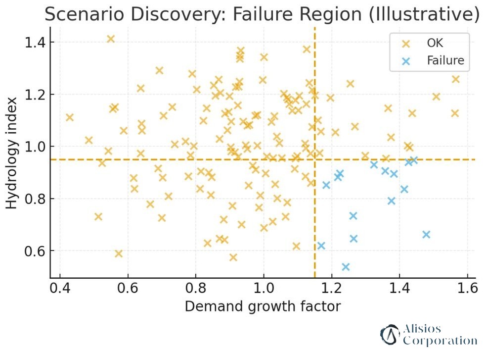
Scenario discovery for energy planning: the combinations of demand growth and hydrology under which a plan fails, found with a PRIM-type rule (Patient Rule Induction Method) — here, demand growth above 1.15 with a hydrology index below 0.95 (illustrative example).
Energy

Energy atlas for planning under climate uncertainty — Mozambique

Client: World Meteorological Organization (WMO)

Under a WMO Letter of Agreement, an energy atlas for Mozambique with hydropower, solar, wind and hazard-exposure layers for energy planning, with training for national teams.

Delivered through Aerthydral Collective

Sibila Room™ for Guayaquil airport (SEGU): lightning observed in the last hour and the Sibila® lightning nowcast for the next 30 minutes (screen recording, March 2026).
Transport

Lightning and storm nowcasting for air traffic — Ecuador

Client: Dirección General de Aviación Civil (DGAC)

Safety-critical nowcasting of lightning and storms around airports: lightning observations updated every two minutes and a Sibila® lightning nowcast for the next 30 minutes, with alerts for air traffic control.

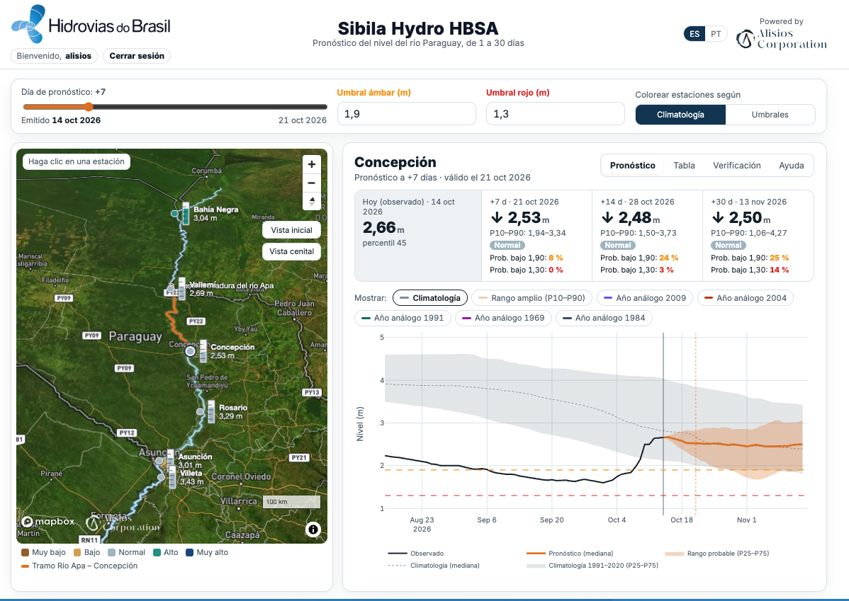
Sibila Hydro HBSA: Río Paraguay level forecast at Concepción, seven days ahead, with its uncertainty range, the client's thresholds and climatology (October 2026).
Transport

River-level forecasting for inland navigation — Paraguay and Brazil

Client: Hidrovias do Brasil

Daily river-level forecasts from 1 to 30 days at seven gauges on the Río Paraguay, with uncertainty ranges and forecast-versus-observed verification, plus river-flow forecasting across several Brazilian basins for navigation and fleet planning.

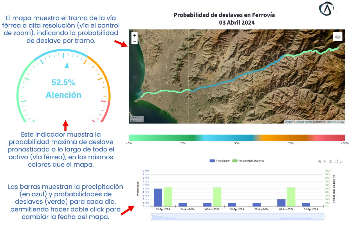
Sibila® Landslides room: landslide probability by section of the railway, the highest probability along the corridor, and daily rainfall and probability (3 April 2024; room in Spanish).
Transport

Landslide and debris-flow forecasting for a mountain railway — Peru

Client: Minera Chinalco Perú

Sibila® Landslides forecasts the likelihood of landslides and huaicos (debris flows) along the Callao–La Oroya rail corridor twice a day. Alert levels are anchored on documented past huaico events, and rainfall is downscaled for mountain terrain. Delivered in the client's own Sibila Room™.

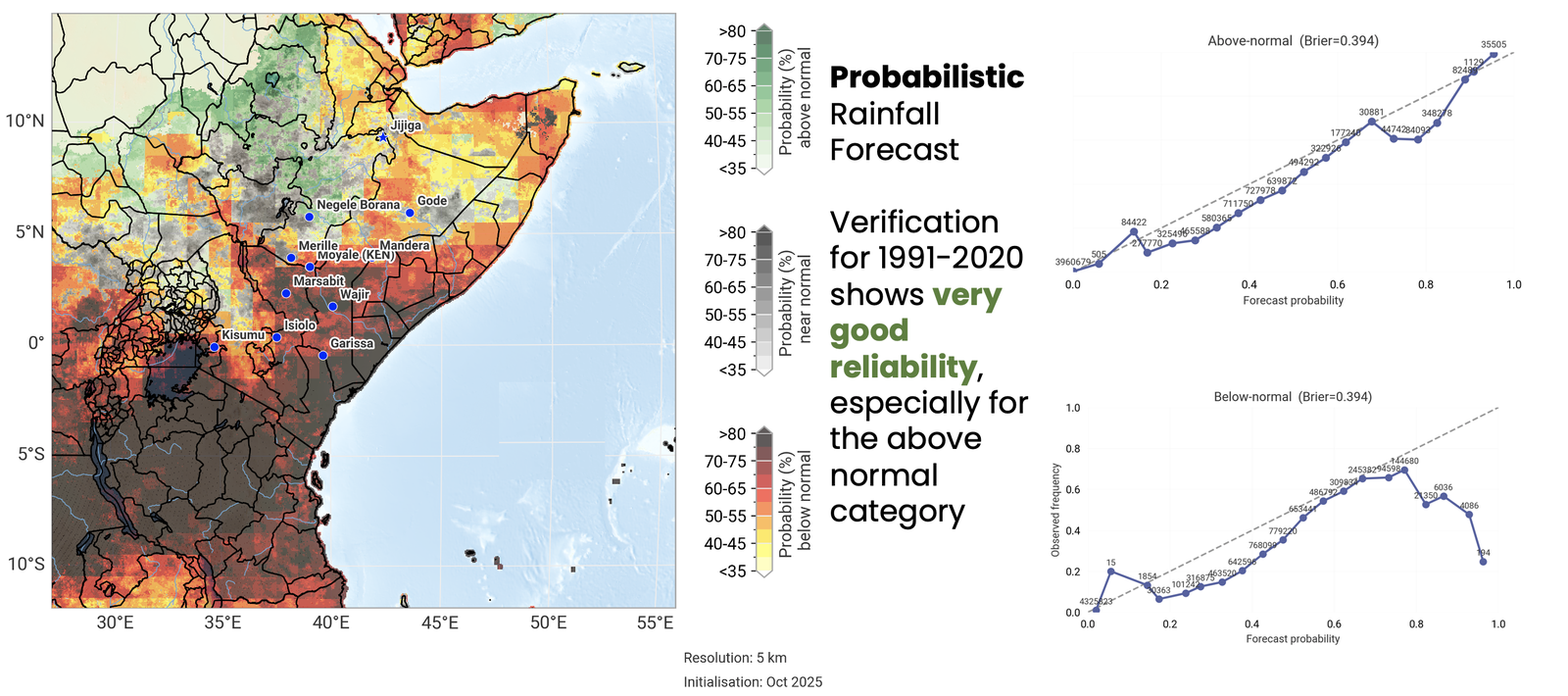
Seasonal rainfall forecast at 5 km and its reliability, 1991–2020.
Food and livestock

Three NextGen advisory systems for livestock — East Africa

Client: International Livestock Research Institute (ILRI, CGIAR)

Three systems that go beyond climate variables to what pastoralists decide on: water availability (WANG), grazing and feeding (GrazFeediNG) and Rift Valley fever hazard over livestock density (NGeRVF), for Ethiopia, Kenya and neighbouring areas. GrazFeediNG, for example, blends a calibrated seasonal rainfall forecast with satellite vegetation into a 5 km pasture-biomass index and five advisory classes, co-designed with the client. Verified against independent dry-matter data: ROC area 0.855 for the above-normal category; our calibration cut the reliability error from 0.301 to 0.004.

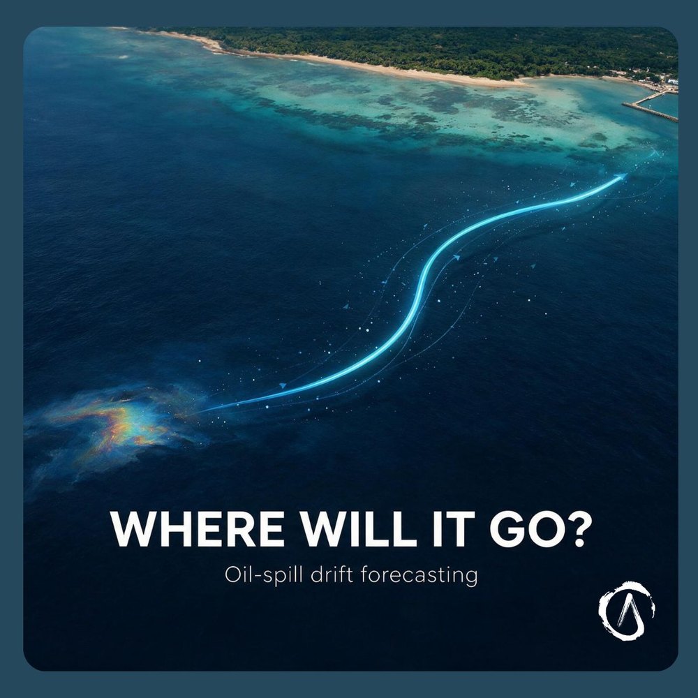
Oil-spill drift forecasting (illustration).
Water and oceans

River and coastal modelling for navigation safety — Colombia

Client: Colombian Navy hydrographic service (CIOH/DIMAR)

River and coastal modelling of the Río Magdalena, including sediment transport, to navigation-safety standards; and oil-spill drift forecasting in the Caribbean.

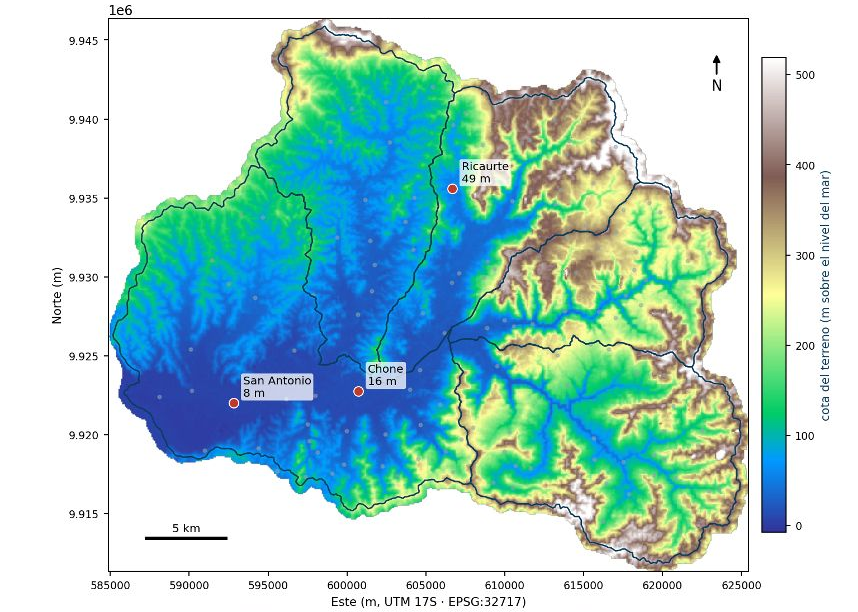
The Chone river basin and the parishes of the threshold analysis (terrain height, m above sea level). Sources: Sigtierras 2010 terrain model and Chone municipal layers provided by GIZ. Prepared by Alisios Corporation under a GIZ contract.
Public policy and risk

Flood early-warning system — Chone, Ecuador

Client: GIZ Ecuador, Ciudades Resilientes programme, with CMC Internacional

Design of the management model for the city's flood early-warning system: hydrological and hydraulic modelling under historical and climate-change scenarios, and impact-based thresholds. 2026–2027.

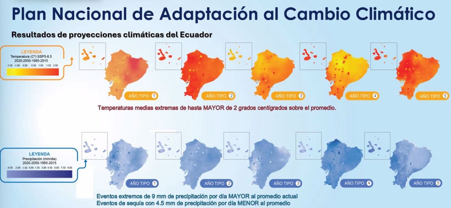
Ecuador: projected change in mean temperature (top) and precipitation (bottom), 2020–2050 against 1985–2015 (SSP5-8.5), for five typical years, as presented in the National Climate Change Adaptation Plan.
Public policy and risk

National climate-change scenarios — Ecuador

Client: Government of Ecuador, for adaptation planning (2020–2021)

High-resolution scenarios with process-based model selection, and the split of past changes into long-term trend, decadal and year-to-year variability.

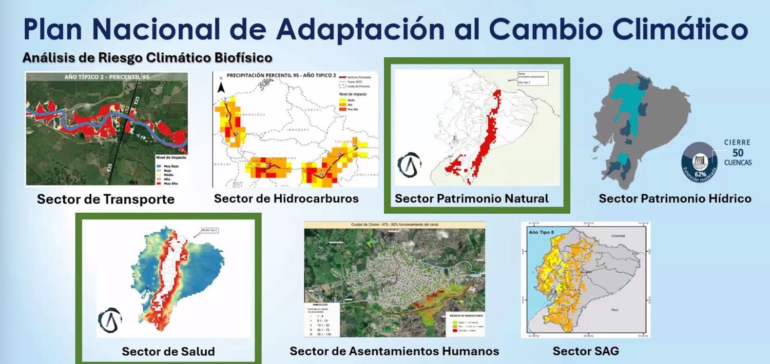
Biophysical climate-risk analysis by sector in Ecuador's National Adaptation Plan; the health and natural-heritage analyses (framed in green) are Alisios's.
Public policy and risk

Sector climate-risk analysis for the National Adaptation Plan — Ecuador

Client: Government of Ecuador, through UNDP — National Climate Change Adaptation Plan (PNACC)

Ecuador's National Climate Change Adaptation Plan built its sector analysis of the impacts and risks of climate change and variability — transport, hydrocarbons, natural heritage, water, health, human settlements and agriculture — on our national climate-change scenarios. Alisios carried out the climate-risk analysis for two of these sectors: health and natural heritage (ecosystems).

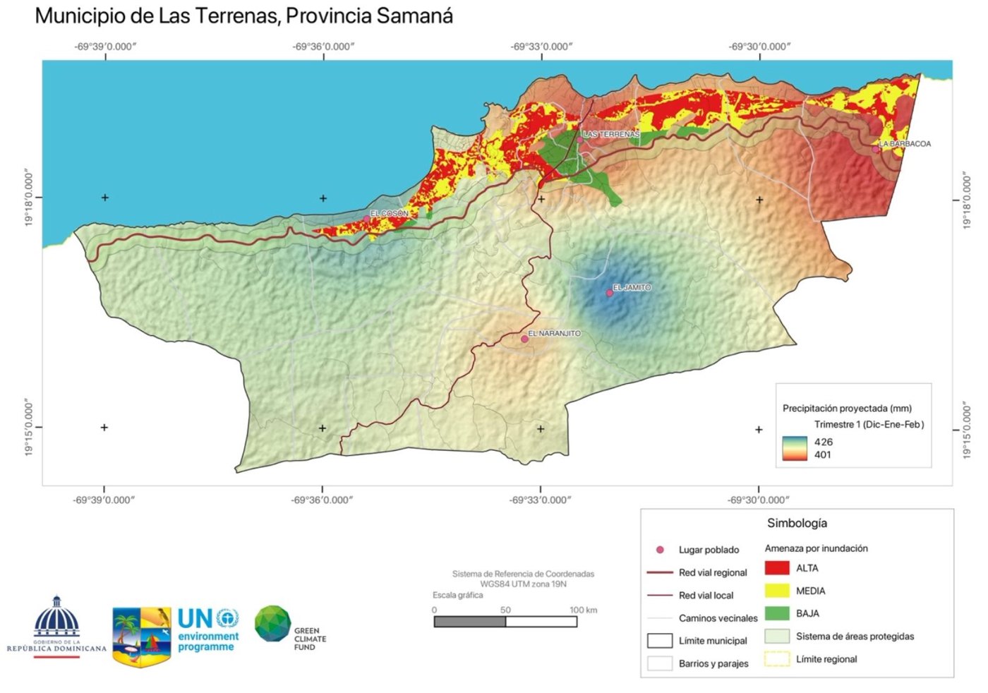
Las Terrenas (Samaná): projected precipitation for December–February and flood hazard.
Public policy and risk

National climate-change scenarios — Dominican Republic

Client: Government of the Dominican Republic, through UNEP — Green Climate Fund project (2024–2025)

Ultra-high-resolution (city-level) climate-change scenarios with process-based model selection, combined with flood hazard for local adaptation planning — for example in Las Terrenas, Puerto Plata and Santo Domingo Este.

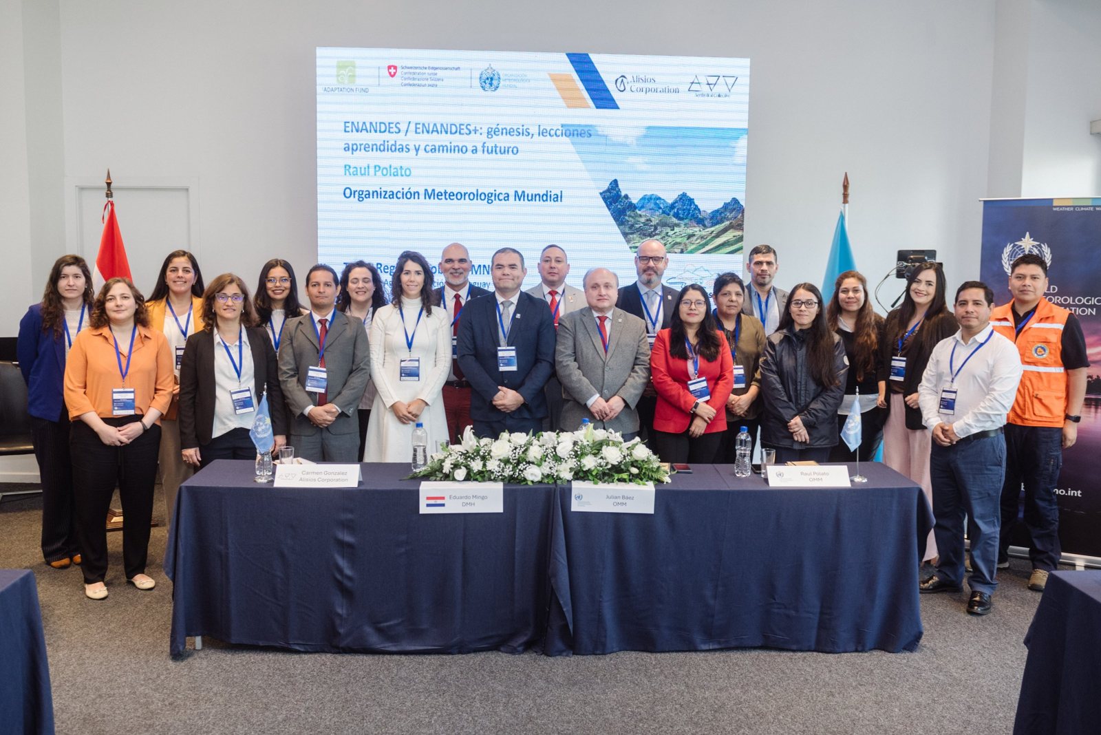
Regional workshop of South American national meteorological and hydrological services, Asunción, August 2026. Photo: WMO.
Public policy and risk

National Frameworks for Climate Services — South America

Client: WMO, ENANDES project (Adaptation Fund, Swiss cooperation)

Design and facilitation of the regional workshop of South American national meteorological and hydrological services (Asunción, August 2026), with a regional synthesis, a policy brief for ministries and the Declaration of Asunción.

Delivered through Aerthydral Collective

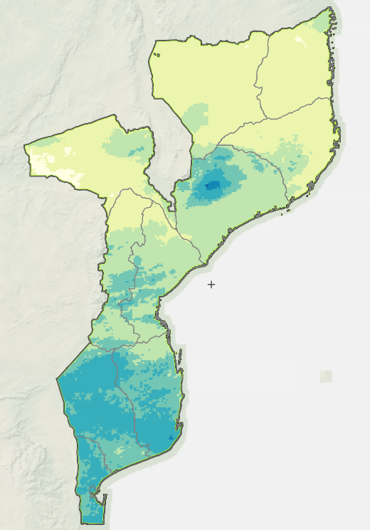
30-day rainfall total to 30 September 2026 (test layer).
Capacity building

Strengthening the national climate services platform — Mozambique

Client: World Meteorological Organization (WMO), with the National Institute of Meteorology (INAM)

Under a WMO Letter of Agreement, we work with Mozambique's National Institute of Meteorology (INAM) to strengthen its own climate services: new climate monitoring layers in INAM's ClimWeb platform, such as 30-day rainfall totals and their percentiles.

Delivered through Aerthydral Collective

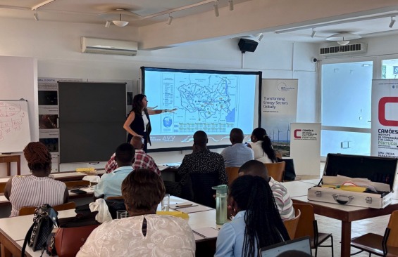
Participants and Dr Carmen González Romero (Aerthydral Collective) during the in-person training in Maputo, October 2025. Photo: Aerthydral Collective.
Capacity building

Climate information for energy-sector planning — training in Mozambique

Client: GIZ, with ALER (Lusophone Renewable Energy Association)

Training for energy-sector professionals on using climate information in sector energy planning and on making decisions under uncertainty, including an in-person course in Maputo (October 2025).

Delivered through Aerthydral Collective

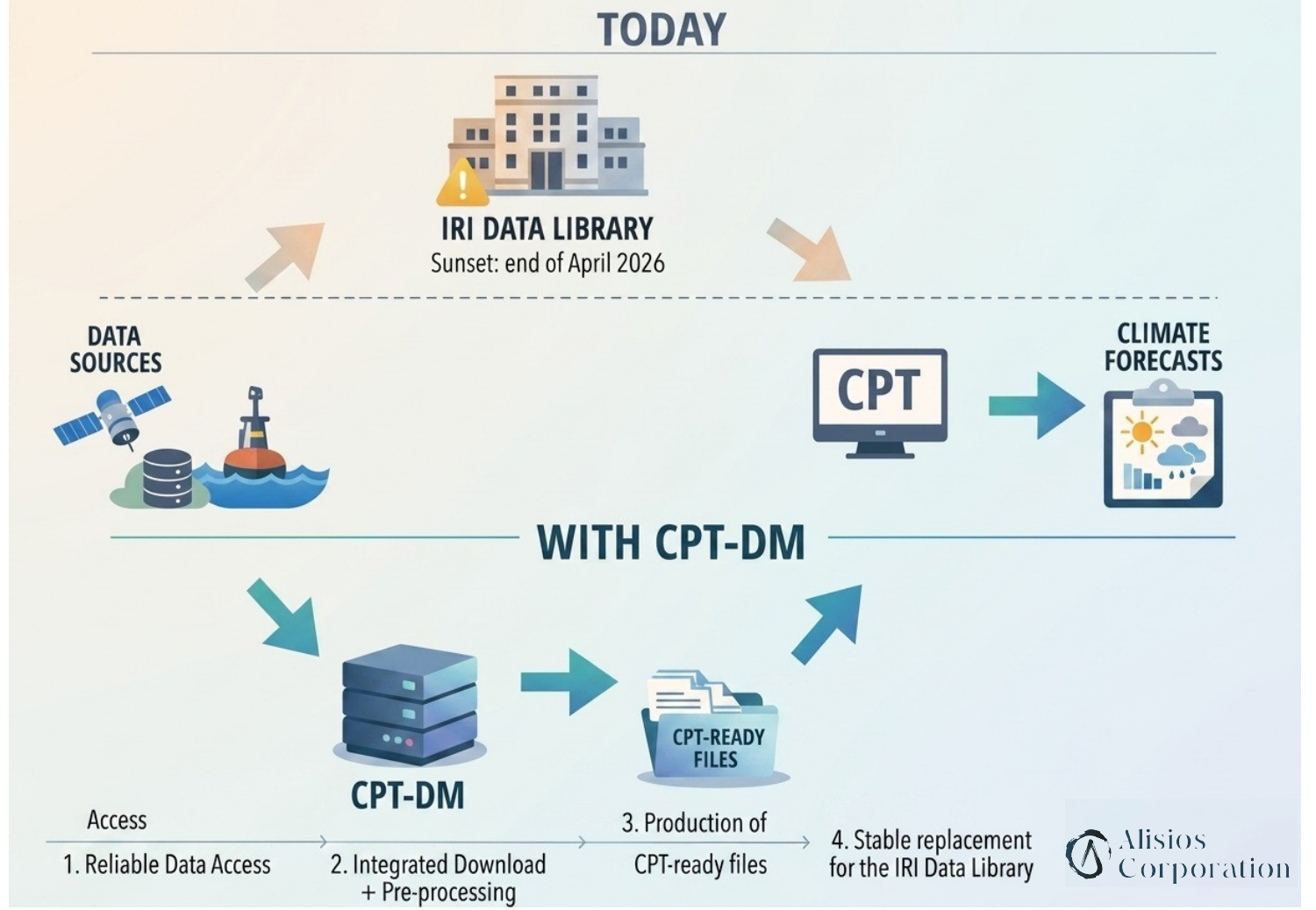
From the retired IRI Data Library to CPT-ready files with CPT-DM.
Open tools

Open data access for intraseasonal and seasonal forecasters worldwide — CPT-DM

Client: Stockholm Environment Institute (SEI), under the Weather and Climate Information Services (WISER) Programme, funded with UK International Development from the UK government and led by the Met Office

When the IRI Data Library, which forecasters around the world used with the Climate Predictability Tool (CPT), was retired, we built CPT-DM: a free, standalone download tool for Windows, macOS and Linux that delivers intraseasonal and seasonal forecasts, hindcasts and observations ready for CPT, and is being integrated into CPT itself. CPT-DM on GitHub.